Aerial Data Deliverables & Outputs
Every output we deliver is processed, structured, and formatted for immediate use in your project workflow — not raw files that need further work before your team can act on them.
What We Deliver
GeoTIFF
A georeferenced, seamless aerial image of your entire site — accurate, measurable, and ready to overlay in GIS or CAD. Updated on every monitoring visit for direct comparison across time.
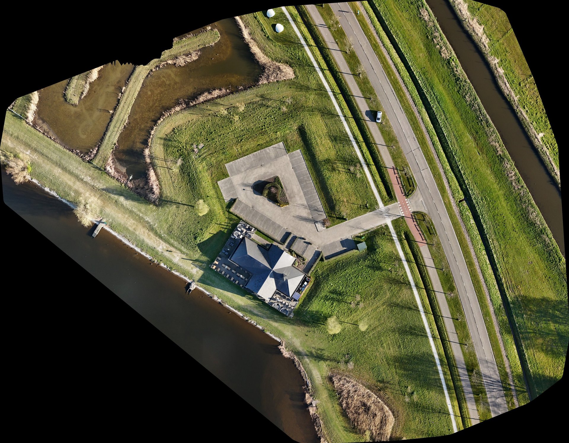

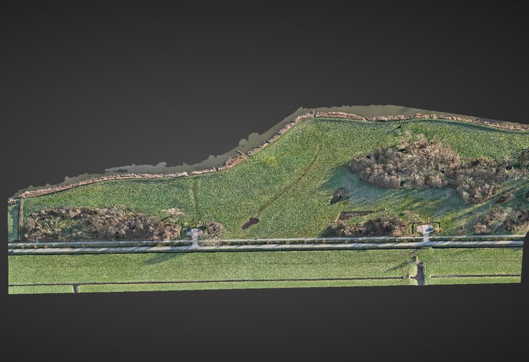
Orthomosaic
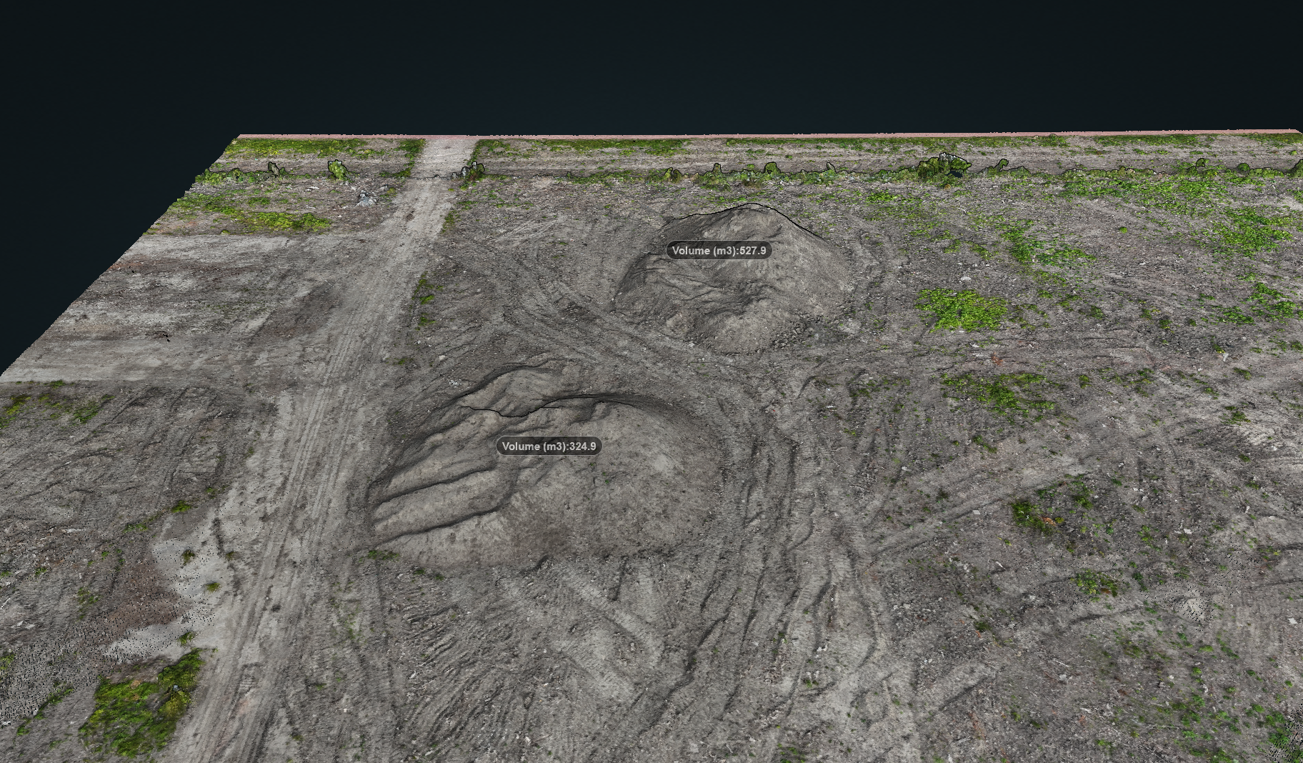
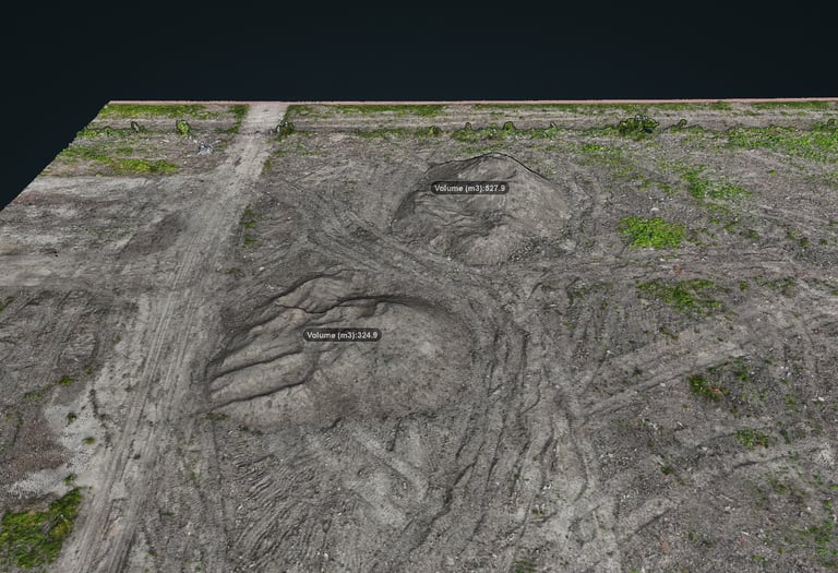
Volume Report
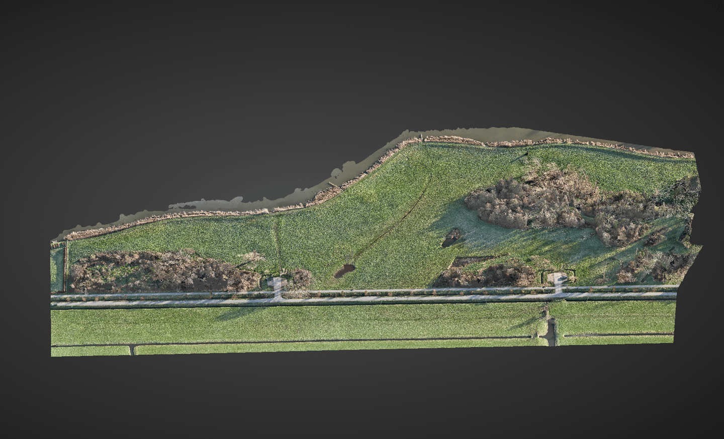
Digital Surface Model
Point Cloud
LAS / LAZ
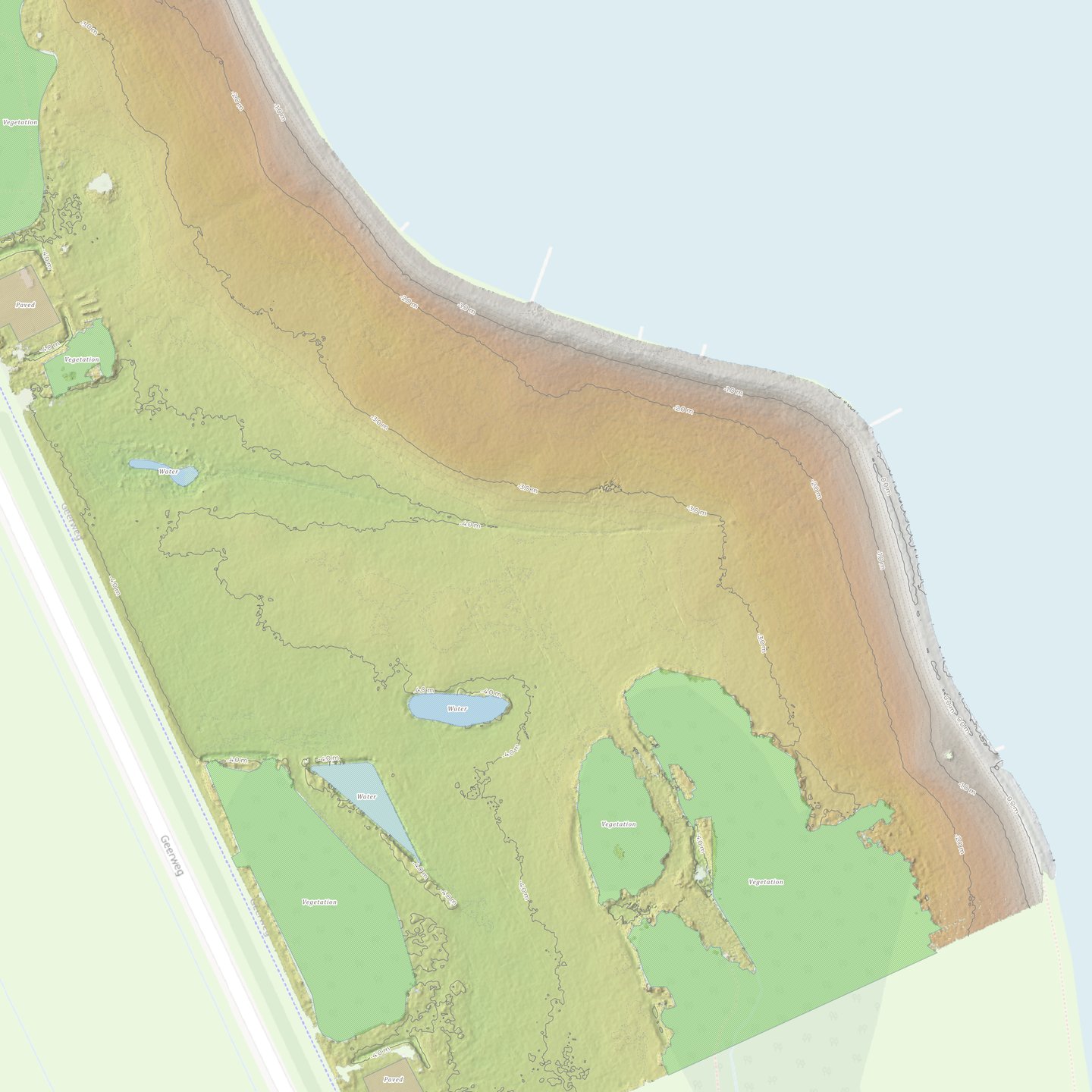
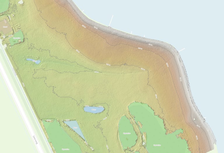
DSM / DTM — GeoTIFF
Elevation models showing surface height variation across your site. Used for drainage analysis, earthworks planning, and cut-and-fill calculations. Delivered as georeferenced raster files.
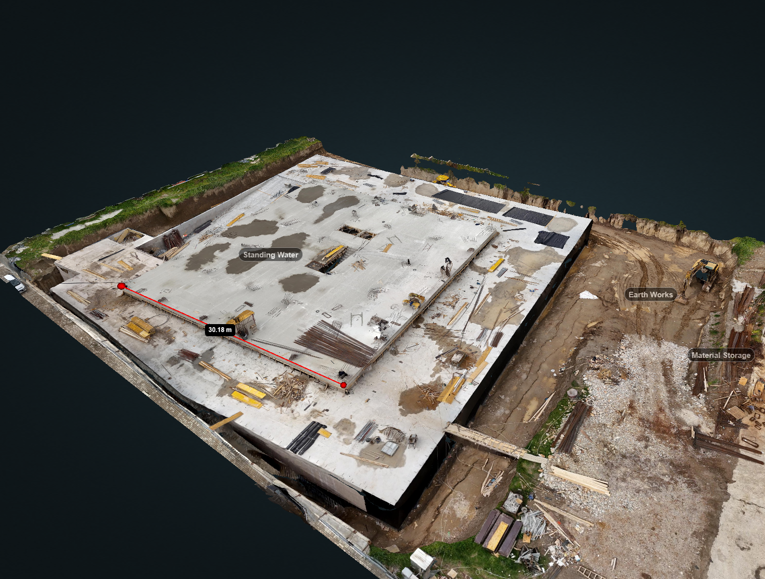
A dense three-dimensional dataset of your site surface — used for volumetric analysis, terrain modelling, and BIM integration. Processed from overlapping imagery using photogrammetry pipelines.
Documented stockpile and earthworks volume calculations with methodology, measurement date, and comparison to previous captures. Suitable for quantity surveying and client reporting.
CAD & GIS Formats
Integration-Ready From Day One
We don't deliver data and leave you to figure out the rest. Every output is formatted for the tools your team already uses — no conversion, no guesswork, no IT overhead.
Before every project we confirm your required formats, coordinate system, and how the data needs to land in your workflow. The deliverable is ready to use the moment it arrives.
DWG — AutoCAD, Civil 3D, MicroStation
GeoPackage — QGIS, ArcGIS, MapInfo
IFC — Revit, ArchiCAD, Navisworks
GeoTIFF — QGIS, ArcGIS, Global Mapper
LAS / LAZ — CloudCompare, Autodesk ReCap
PDF — Inspection and volume reports
KMZ / KML — Google Earth, field survey apps
Progress Monitoring Reports
For clients on recurring monitoring retainers, every site visit produces a structured progress report alongside the raw data deliverables.
Reports are formatted for project managers and stakeholders — not technical specialists. Clear traffic light status, volume delta from the previous visit, annotated aerial imagery, and a summary of observations.
Delivered as PDF within 48 hours of the site visit.
Every Project
Projects delivered on scope
PDF + Data
48hrs
Every monitoring visit
Report delivery target
Inspection Reports & Annotations
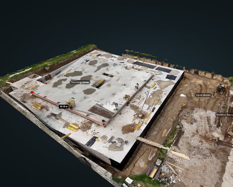
Roof, facade, and infrastructure inspection deliverables include a structured PDF report with georeferenced annotations marking observations directly on the aerial imagery.
Each observation is numbered, described, and located — giving your maintenance team or contractor a precise, actionable document rather than a folder of unlabelled photographs.
Georeferenced annotation on orthomosaic base
Numbered observation log with descriptions
High-resolution image crops for each observation