
Turning Aerial Data Into
Actionable Insights
SOLA Aerial Insights provides professional aerial data and drone
mapping services for construction SMEs across the Netherlands.
Based in Zuid-Holland, we deliver workflow-ready outputs in
DWG, GeoPackage, IFC, and GeoTIFF formats.
EASA certified — A1, A2, A3, STS.
Regular aerial monitoring that keeps your construction project on
track — Workflow-ready data for teams across the Netherlands.
Our Services
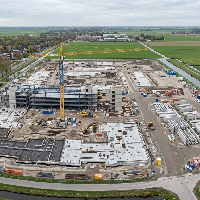
Construction Progress Monitoring
Regular aerial surveys giving project managers an objective, repeatable view of site progress — comparable across time.
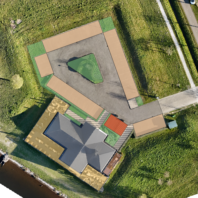
Site Mapping & Documentation
High-accuracy aerial mapping with RTK and GCPs. Outputs ready for AutoCAD, Civil 3D, and GIS.

Asset & Building Inspection
Roof and facade inspections with high-resolution imagery and annotated reports. Reduces access costs and delivers repeatable documentation.
Accurate Data Capture
RTK workflows and Ground Control Points delivering ±2cm accuracy. EASA compliant across urban, rural, and controlled airspace.
Structured Deliverables
Orthomosaics, point clouds, volume reports, DSM/DTM — processed through professional photogrammetry pipelines, not consumer apps.
Integration-Ready Formats
DWG, GeoPackage, IFC, GeoTIFF — in the formats your team uses. AutoCAD, Revit, Civil 3D, QGIS. No conversion required.
Why SOLA Aerial Insights
Workflow-ready outputs — DWG, GeoPackage, IFC, GeoTIFF
Recurring monitoring packages built for SME budgets
Transparent fixed pricing — named packages, clear price bands
Adoption support and onboarding included as standard
EASA certified operator based in the Netherlands
“Most drone operators deliver imagery.
SOLA Aerial Insights deliver answers.”
01. Project Brief
Submit your Project Scope request. We respond within 24 hours to begin scoping your project
02. Mission Planning
Airspace checks, site assessment, GCP placement, and flight mission design — documented before we arrive.
03. Data Capture
Professional drone operations under full EASA compliance — RTK positioning, structured overlap, systematic coverage.
04. Delivery & Onboarding
Outputs in your required formats, with a walkthrough so your team uses the data from day one.